Driving across the United States
PART 5: Wall, South Dakota; the Prairie Museum; and Badlands National Park
As we continued across South Dakota, it became apparent we would be driving through Wall and the nearby Badlands National Park. I told Rob about how enthused my parents had been about the “amazing badlands” and how it was one of those places everyone should see for themselves.
With that destination set, we slowly climbed higher and higher. Randomly spaced Wall Drug signs kept us amused and were our encouragement to keep going — for some 200 miles.
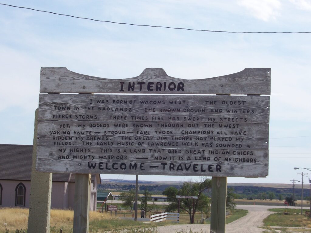
Wall, South Dakota: Home to Wall Drugs
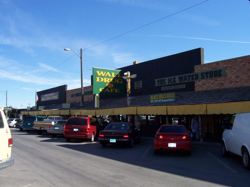
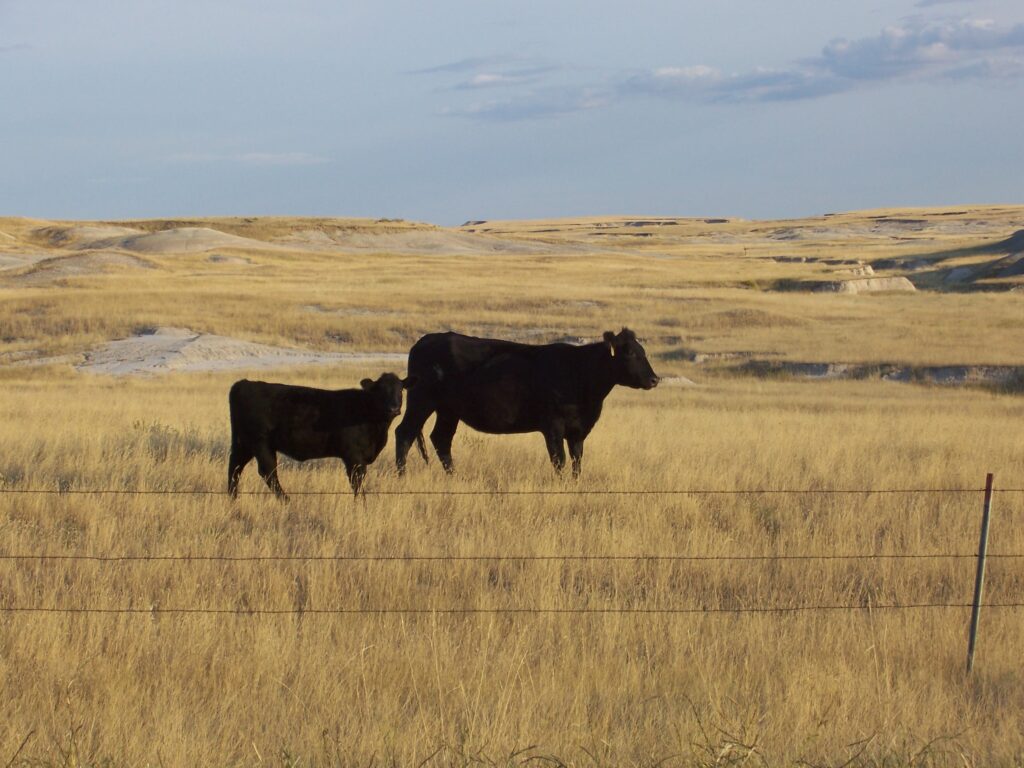
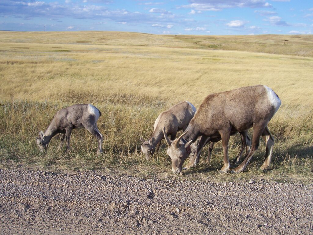
A small town of some 850 human residents, Wall also is home to an untold number of stuffed and manufactured “others,” not even counting living bison, bighorn sheep and prairie dogs that call this area home. The town itself is a bustling little place that hosts about two million visitors every year.
We found Wall to be a friendly town. The main street resembles the sets from all those Western movies we saw as children. Wall Drugs is a very BIG drug store with quite a history. There are several souvenir shops and lots of oddities.
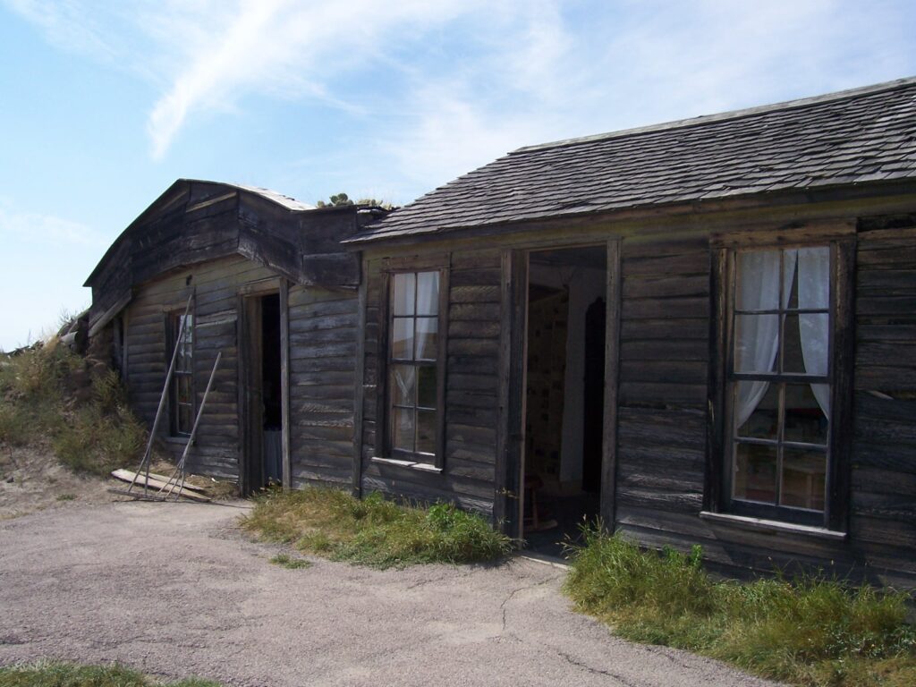
Prairie Museum
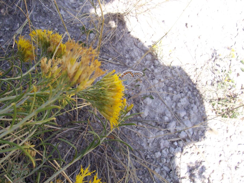
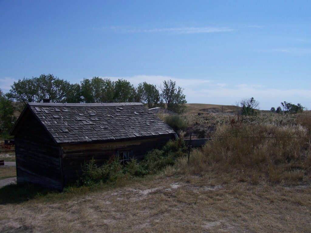
On the road leading to the entrance of the National Park, we stopped for a café that had prairie dogs frolicking outside; and again to visit a Prairie Museum. For a fee, you first watch a short tape giving the history of the family who settled here and then you walk outside and roam on your own around the buildings and surroundings to get a feel for what living on the prairie was like in the early-1900s.
The buildings are made from wood but trees are a premium. So it leaves you to wonder how many buildings any homestead plot could have produced. Or, for that matter, how they kept the home fires burning to cook or heat in the winter months.
Times were tough and the people had to be hardy to survive in this place. They mounded dirt up around the windward side of the buildings to give them some protection and insulation from the winds which had to be brutally cold, come winter.
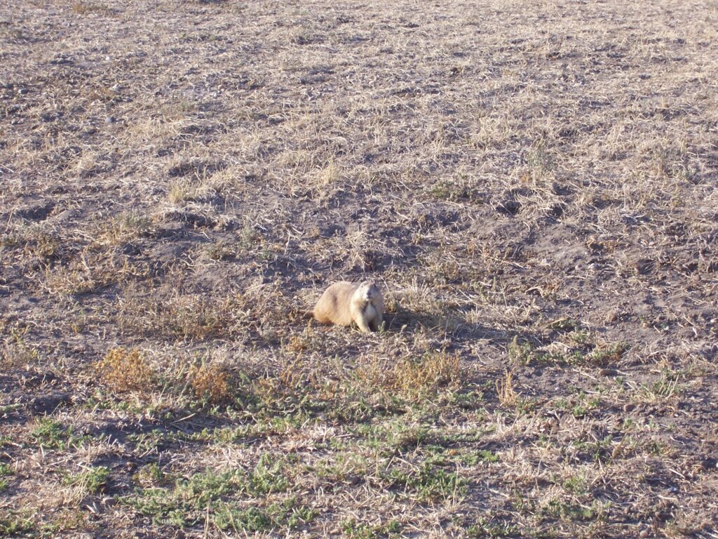
The shed is just big enough to give some protection to whatever minimal livestock the family may have had. Today, the grounds are home to a family of albino prairie dogs – they scatter and run so fast at first you think you’re seeing things; then the shear number of burrows starts to filter through to the brain. You try to imagine how many of these little guys live under your feet.
The Lakota people called this area Mako Sica (bad lands)
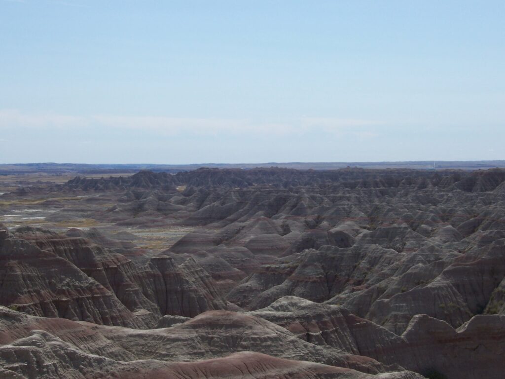
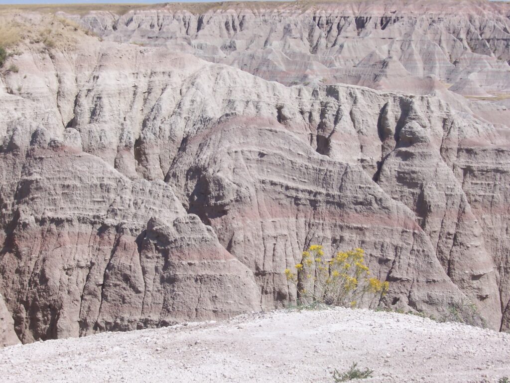
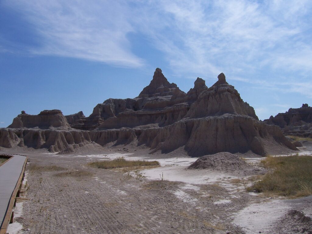
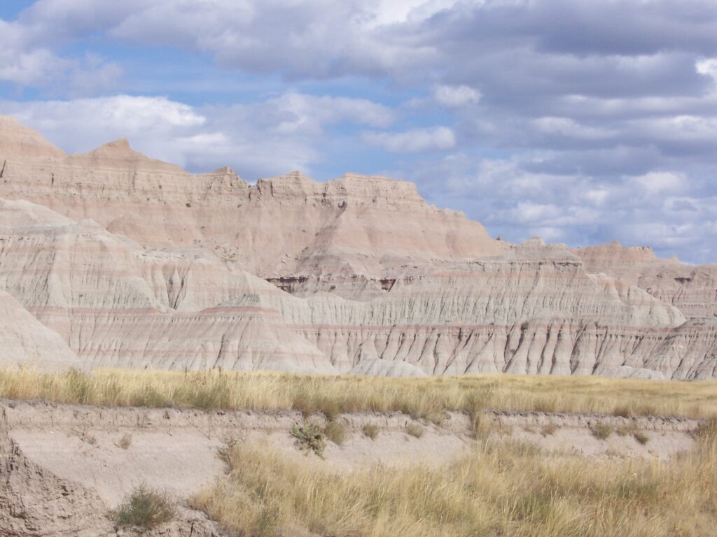
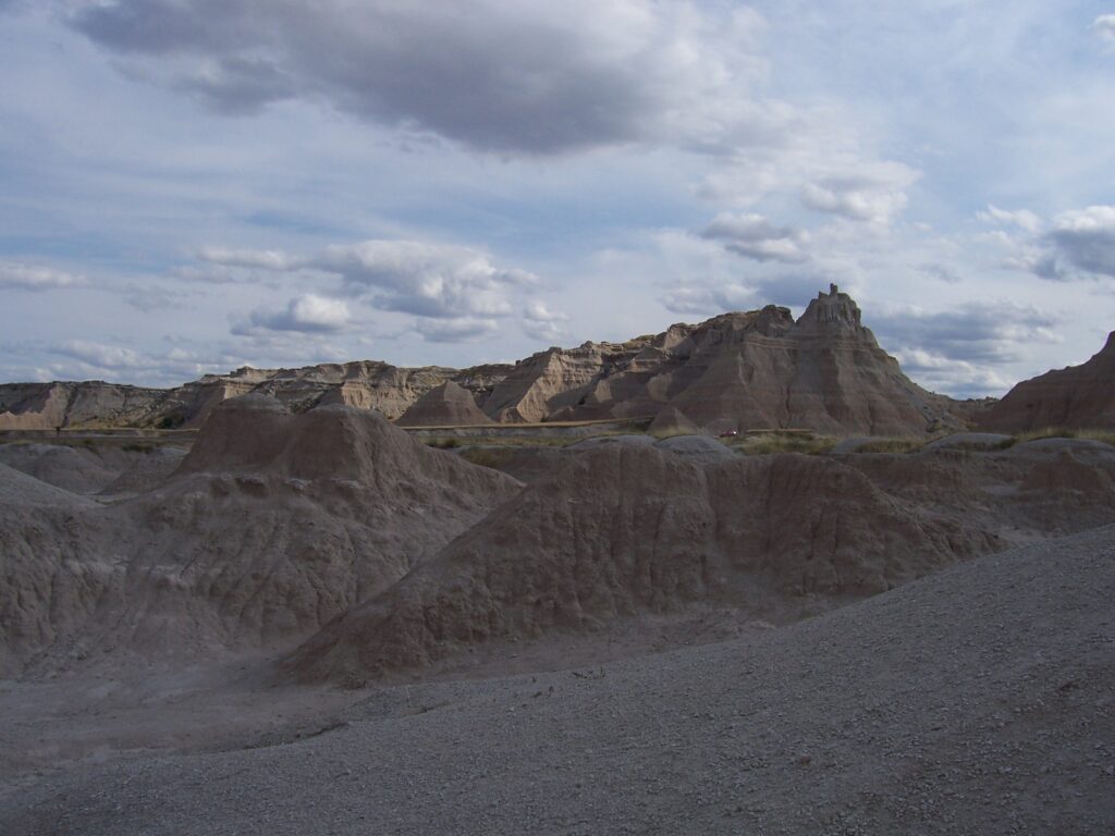
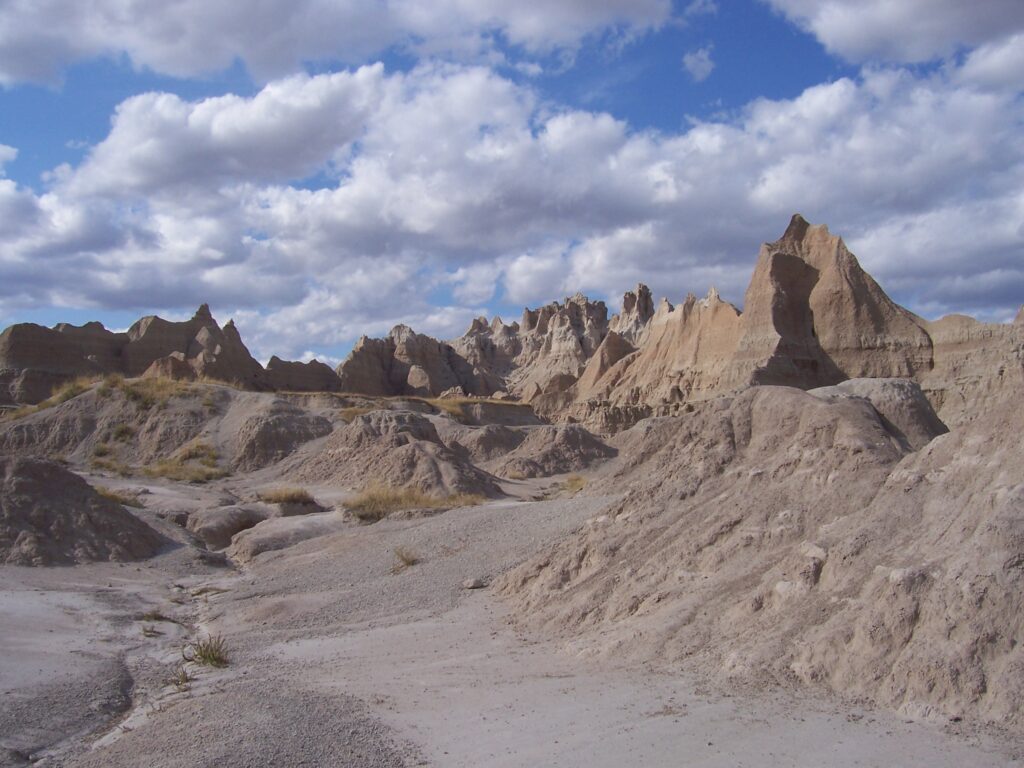
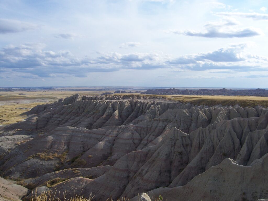
As you enter the Badlands National Park you finally understand where Wall, South Dakota, got its name. A 60-mile long, sheer cliff escarpment quite literally is the formation known as “The Wall.” It is made of near vertical exposed sandstone and defines the boundary between the lowlands and the highlands.
The entry fee in 2005 was $10 and good for three days. The paved loop road winds around and has several designated scenic overlook spots from which you can take photos, walk around and learn about the amazing terrain.
The signs say The Wall is moving north, each year. At first glance, that seems amazing in itself; that this apparently solid “thing” could move. When you get closer, however, you can see how much of nothing these rocks really are – even though they don’t crumble to human touch.
A geologist’s dream terrain
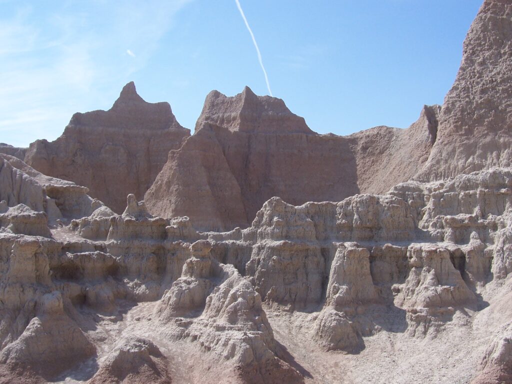
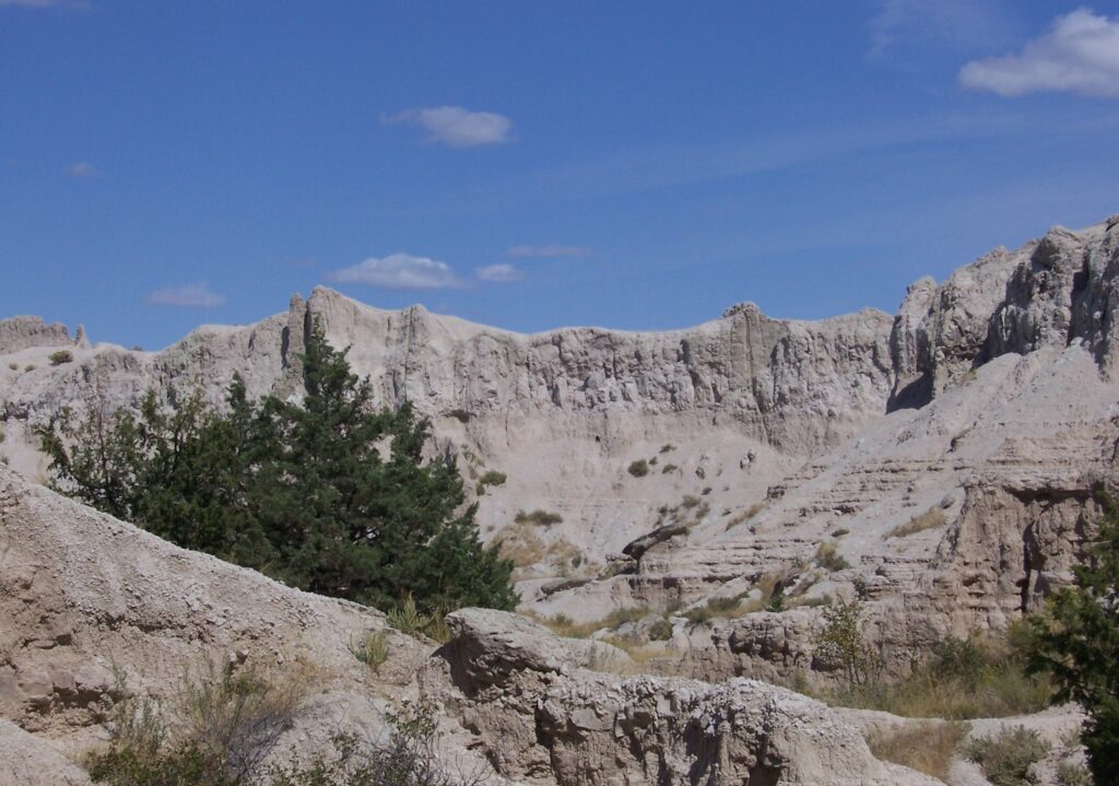
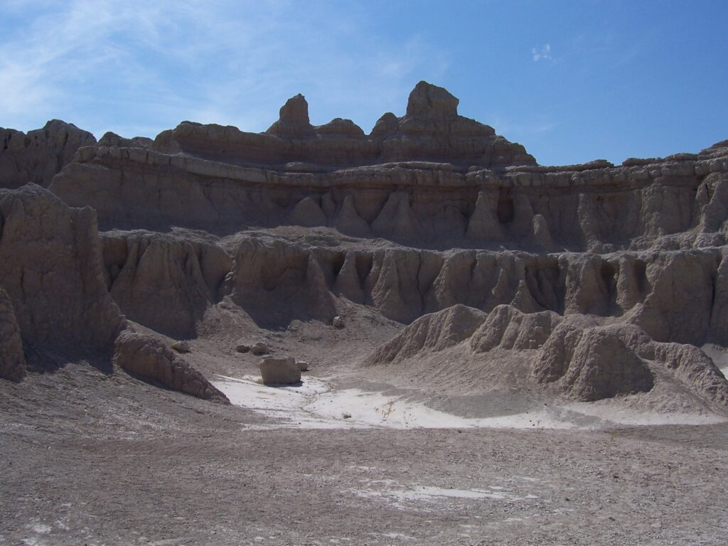
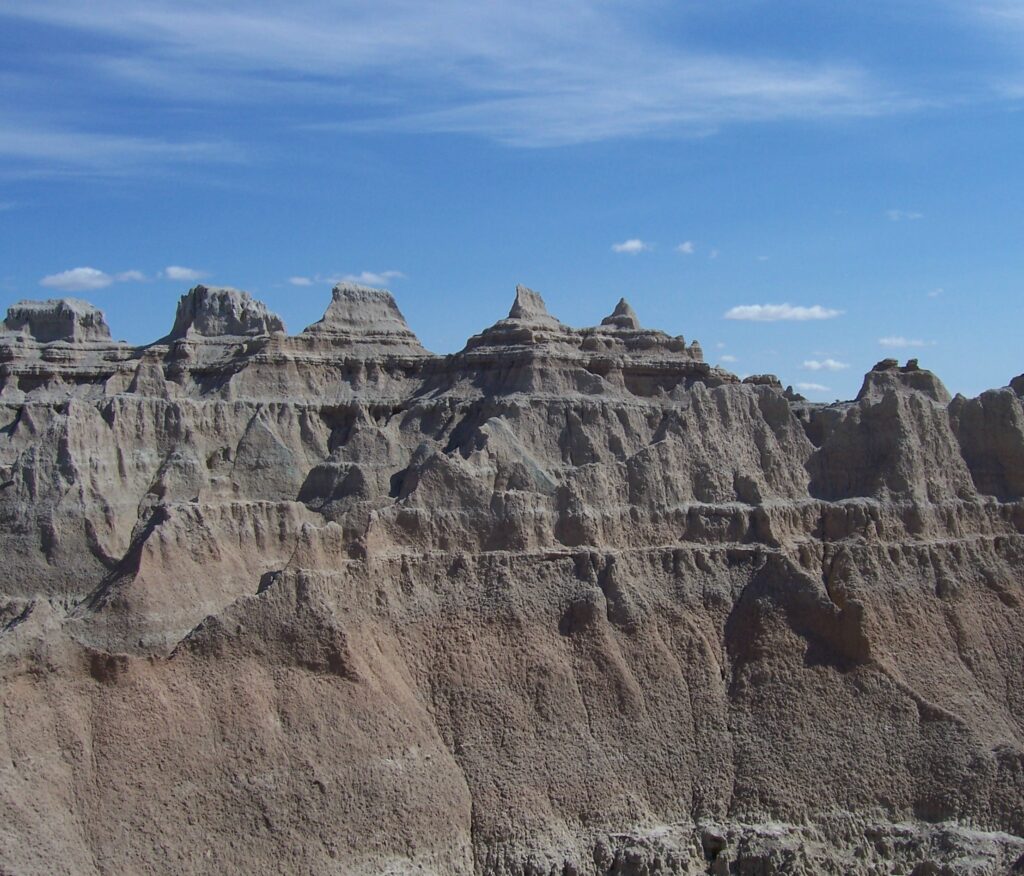
Geology students must love this place where it is so easy to see the different levels of rock as horizontal bands of red and white stretch for miles. Okay, they are probably more mauve and light grey, but not everyone has an artist’s sense of these things.
Even the parts that could be called “wall” are not perfectly straight vertical cliffs. They more resemble a series of inverted cones, squished together at their bases…the effect of wind erosion that blasts pieces off the face at the top and scatter the debris at the base, building up piles every year.
The winds whipping up and across the prairie are powerful forces. We know first hand about prairie winds now, too, as we stopped several times to walk around. The winds don’t seem to stop because there simply is nothing to stop them. No respite from what starts out as refreshing but in its never ending huff, becomes oppressive in itself to this nor’easter.
An artist’s eye to landscape design
Each color of rock has its own granularity. Up close, the white is much larger grained than the red with splotches the size of a fist, interspersed in a macro-grain.
The red bits are much finer, but still coarse. None of this terrain looks like the solid rock we see in the northeast. At one point, a yellow rock is added that seems to make the red brighter. The yellow, it turns out, is from prehistoric lake bottom and the red was blown over from the west.
The Badlands are oddly beautiful for all the desolation. There are places where you can look across an abyss to see cone-walls with horizontal bars of red and white; dusty, almost fuzzy, like well washed flannel.
The futility of capturing beauty*
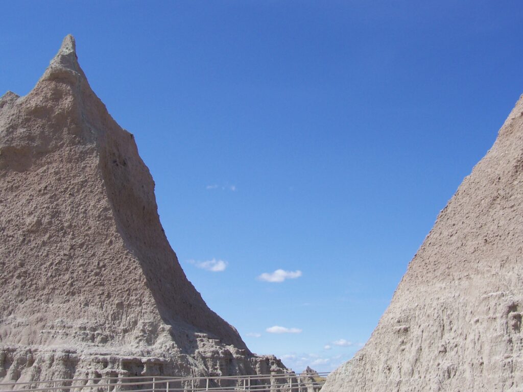
The blue sky against the top, white level is bluer than blue – like those fabulous calendar photos we see of the ruins in Athens, Greece. The rows of puffy clouds that hang in the sky with smudgy dark bottoms are unlike any others we have ever seen. This vision, this personal mind-picture, must be saved as a memory for no camera could do it justice; maybe it could be painted as a watercolor, but oils would be too harsh.
We marvel at this place, for it is special. We understand now why all who have come before have remarked on its beauty. Well, everyone except for the Lakota chieftain who, when brought nearby to relocate onto a reservation, remarked, “Land bad.”
Experienced visitors set alarms so they can see the Badlands as the sun comes up. Our tardiness this morning means we are not in sync with all of them as we drive through. This is good, as we enjoy the less populated rests at the overviews.
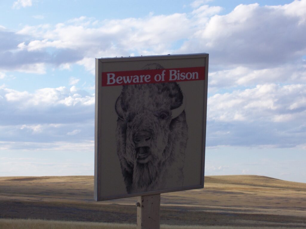
At one point, we took a gravel road to a town called Scenic – just to check out the buffalo grazing area. Instead we found Robert’s Prairie Dog Town. Unreal. For as far as you can see, the ground is riddled with mounds of dirt and thousands of prairie dogs pop up and down, scurrying from hole to hole. We laugh about their effect on the erosion of this limestone. Alas, the only buffalo we sight is the one painted on the sign, “Beware the Bison.”
Lunch place mat has the recipe for Fry Bread
We drove for a long time on the back roads before stopping for lunch at the Badlands Cedar Pass Lodge: Indian Fry Bread with Indian Taco Topping.
The Fry Bread was delicious, fresh and the best we had. To make it: mix together ¼ cup sugar, 2 cups flour, 3 teaspoons baking powder, 1 teaspoon salt and 1 cup water (or enough to make soft dough) and then, using a big spoon, drop the dough onto a floured surface and pat it down to about an inch thick before frying it in one-to-two inches of oil at 350 degrees (F) until golden brown.
The Indian Taco Topping is made by browning buffalo meat and then stirring in refried beans and taco seasoning. You just spread that mix on top of the fry bread and add typical taco accompaniments, like shredded cheese and lettuce, salsa, sour cream and guacamole.
Cloud paintings of spirit animals above The Wall
While eating lunch, I watched over Rob’s shoulder as the clouds shifted in position and shape over The Wall in the distance. In one moment there seems to be a line of animals, standing on their hind legs in some odd ballet-like stance – a bear and a couple of coyotes from a circus, perhaps – and then the sun shifts and they fade away, leaving overlapping cone-shaped mounds of grey and mauve.
It made me wonder if what I saw was real or not and then, poof, before the thought took hold, the cloud moved again and a silhouette of a fox and bear appears, quite clearly. Given a toke of peyote, we could easily become mystic visionaries in this place. Stand still for an hour and you will see many different scenes along The Wall.
It was late afternoon as we left the park toward Rapid City where we will spend the night. The terrain changed yet again as we moved closer to the Black Hills of South Dakota. Up, up and up, to an elevation of 3,200 feet. But that is a story for another day.
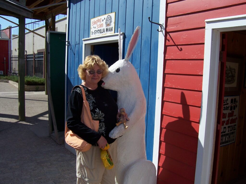
Bunny kisses 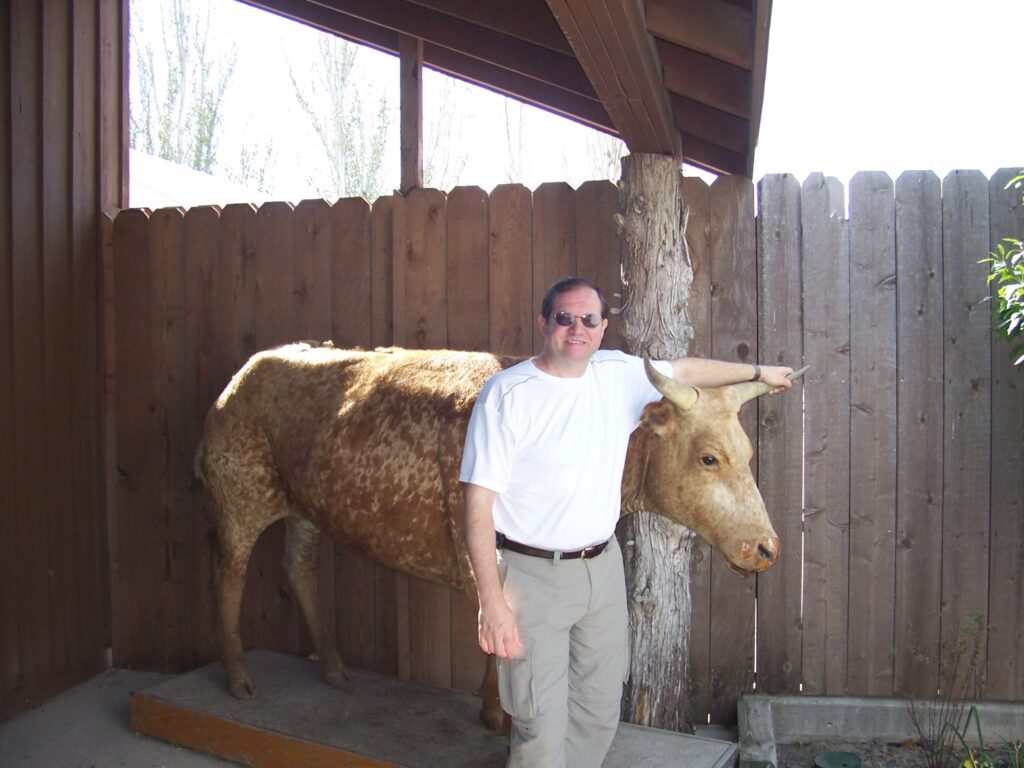
Cowboy Rob
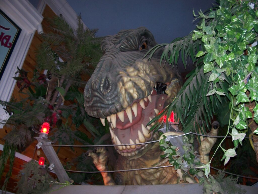
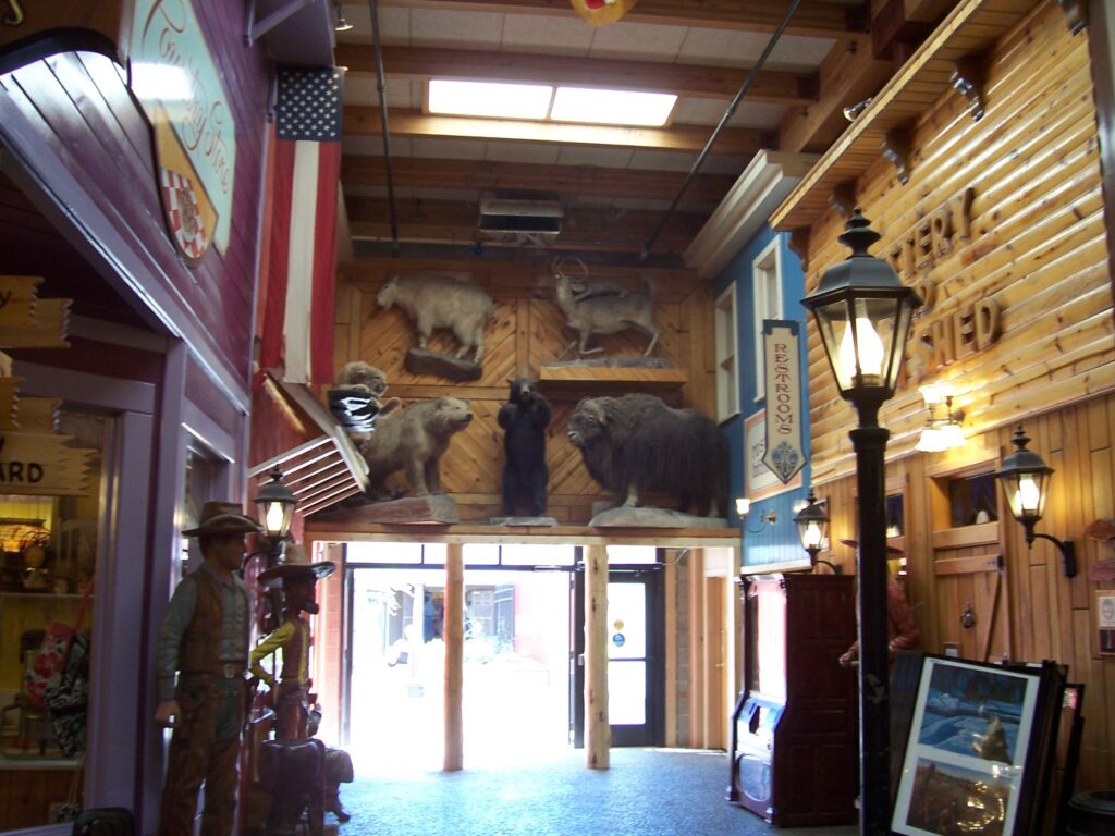
We wandered around Wall so much we nearly got lost — among the critters!
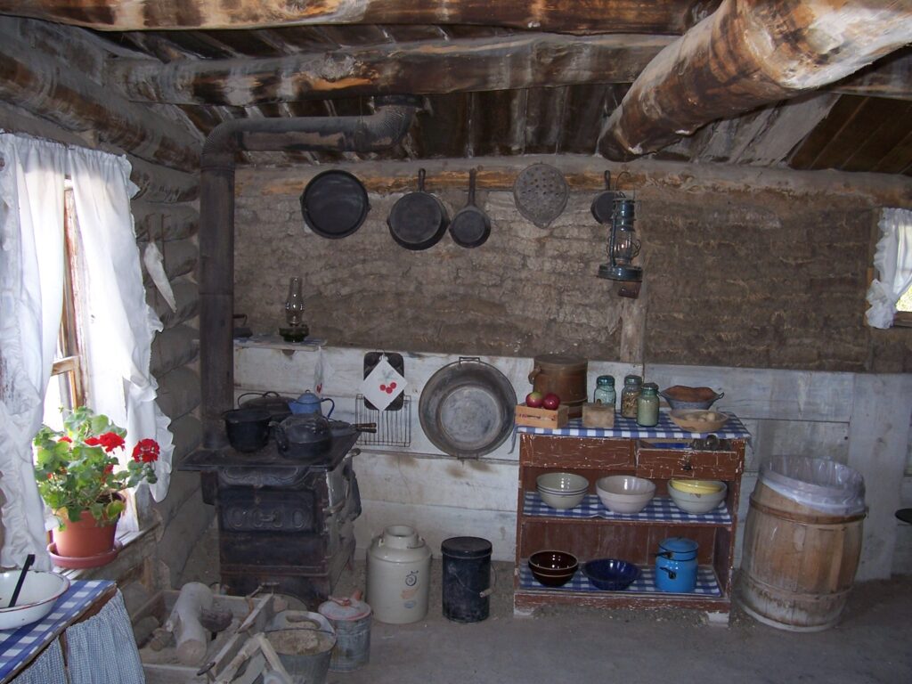
Kitchen 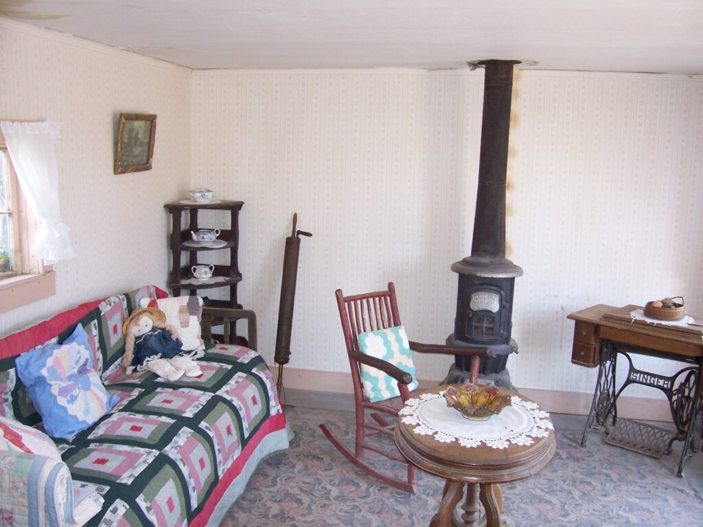
Fancy Parlor 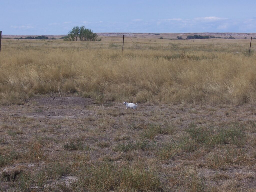
Front Yard 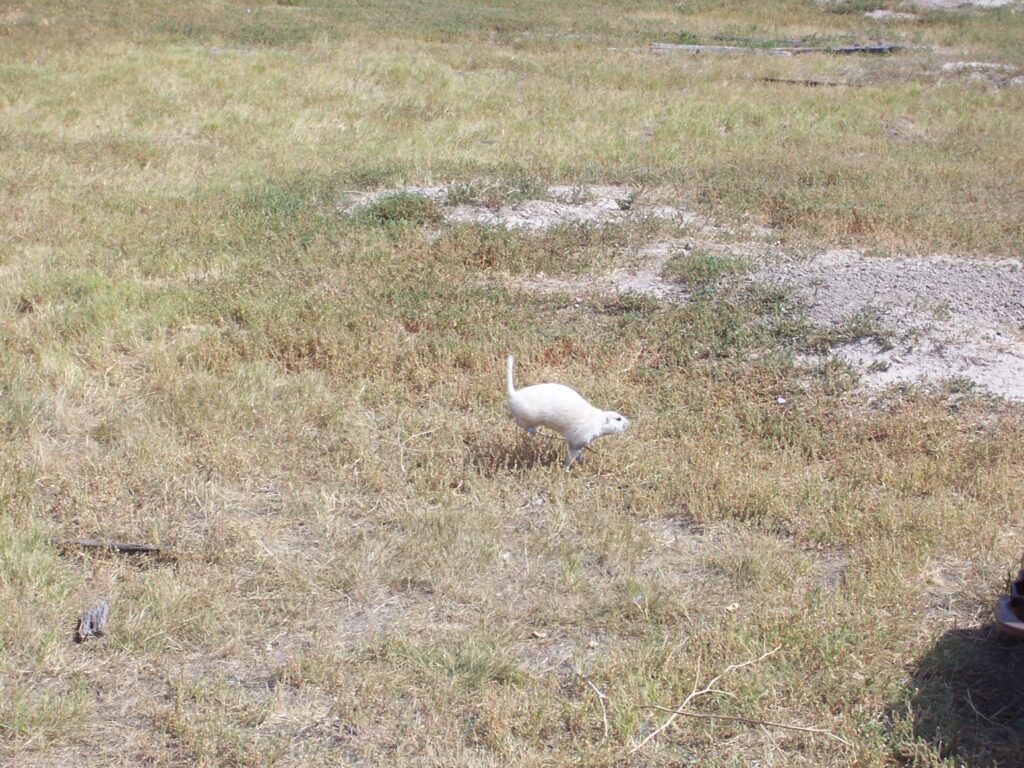
Albino prairie dog 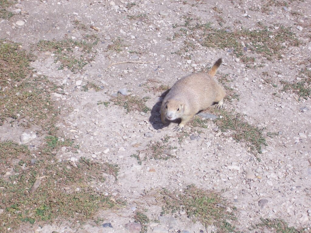
Cutie Pie 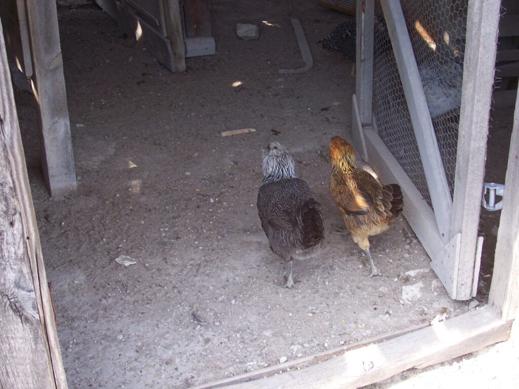
Prairie Chickens
Read this article on Travel South Dakota for a nice explanation of the Homestead Act and the people who purchased 160-acre plots for $18 — all theirs if they could live on it for 5 years.
No, this isn’t Egypt.
The Wall, Badlands National Park
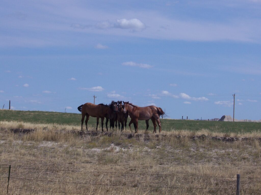
How many horses do you see?
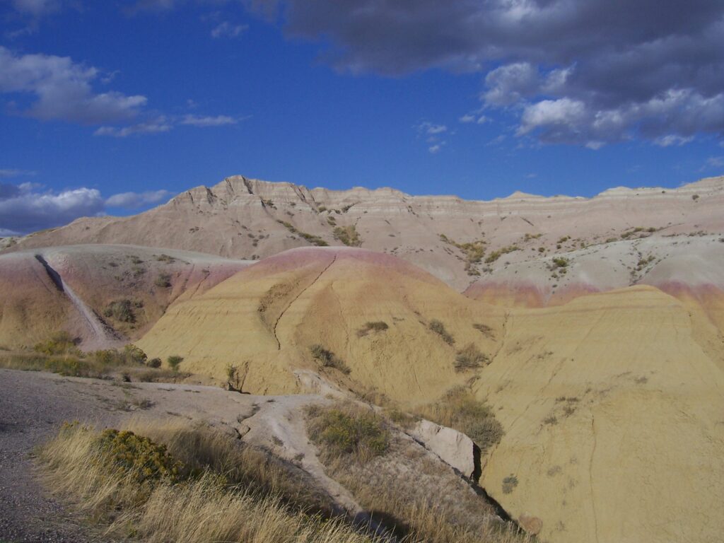
Yellow from prehistoric lake bottom
Robert’s Prairie Dog Town resident
*See my poem, Florida Sunset, for another explanation for this thought.