Driving across the United States
PART 8: Wyoming and the Big Horn National Forest, Thermopolis and Shoshoni National Forest
At the Information Center as we crossed into Wyoming, the lone attendant — Kathleen — had been surprised we were not heading toward Sundance or Yellowstone National Park. When she heard we were heading to California she suggested a diagonal sort of drive that would let us get off the interstate system and provide a spectacular view of Wyoming. Who could pass that opportunity up, right?
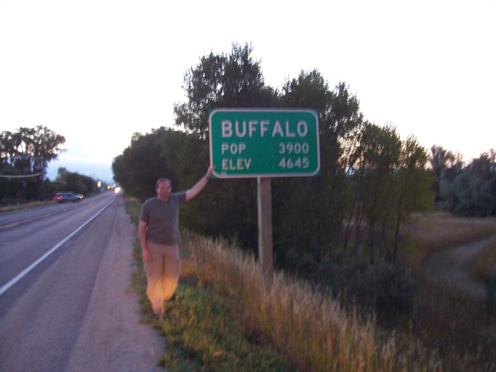
We said yes to the directions and headed straight to — Buffalo, for the night. Made us laugh to think we’ve driven so far, seen so much, and were going to a place named Buffalo. We needed a meal and a bed after a long day saying our goodbyes to South Dakota. Rob was not feeling well — too long a day? Altitude? Not sure, but a stop was all that was needed to put us both back to normal.
Wyoming — the land of children’s fantasies about cowboys and living on the open range. At the end of the day, we both wished we could go back and give Kathleen a giant hug because the 349-mile drive was spectacular. What a gift.
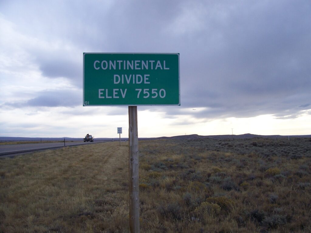
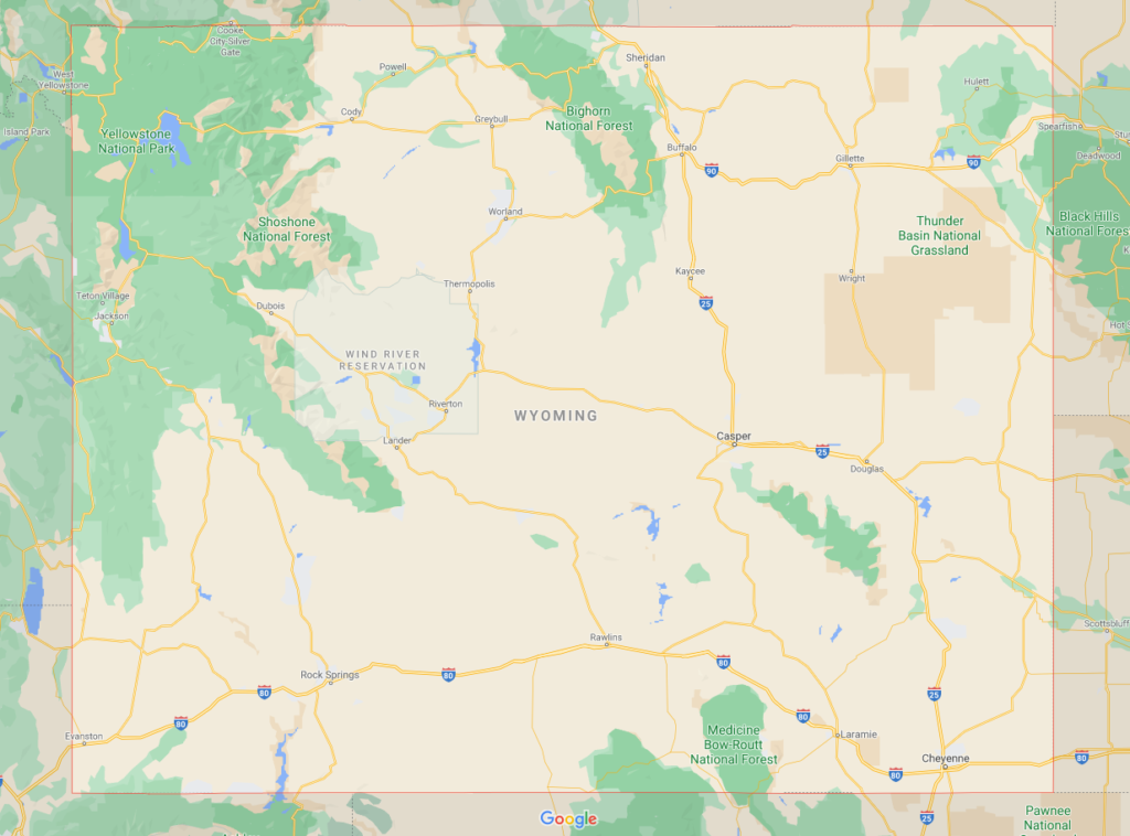
For route plotters [and those looking for what is one of the most beautiful drives you can take in the United States, I’ll violate my usual rule and tell you the way to go in Wyoming. In all cases, the “S” with a route number does not indicate direction; it indicates a state route number. Starting in the NE, we took S16 West, going roughly southwest to Worland, through the Big Horn National Forest, then down to Thermopolis. From there, S20 goes due south to Shoshoni, where we hung a right on S26 to Riverton to catch up with 789 to Lander and S28, around the Shoshoni National Forest to our west – where we crossed the Continental Divide – and then, at Farson, we followed S191 to Rock Springs.”
From our Journal, entry 007, Buffalo to Rock Springs
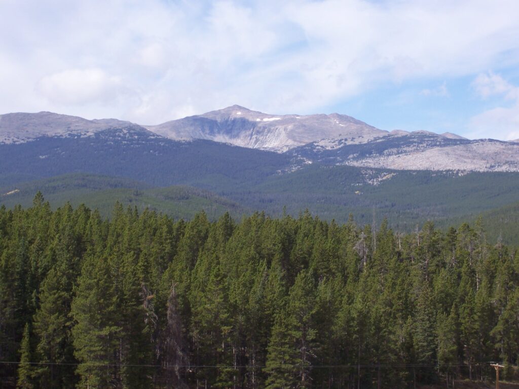
Once again we found ourselves driving up and up. Although it has been thousands of miles since we left New Hampshire, we begin the day’s journey still east of the Continental Divide. The car is not young and we wonder if we will make this day’s journey and who would be around to “save us” if that were needed.
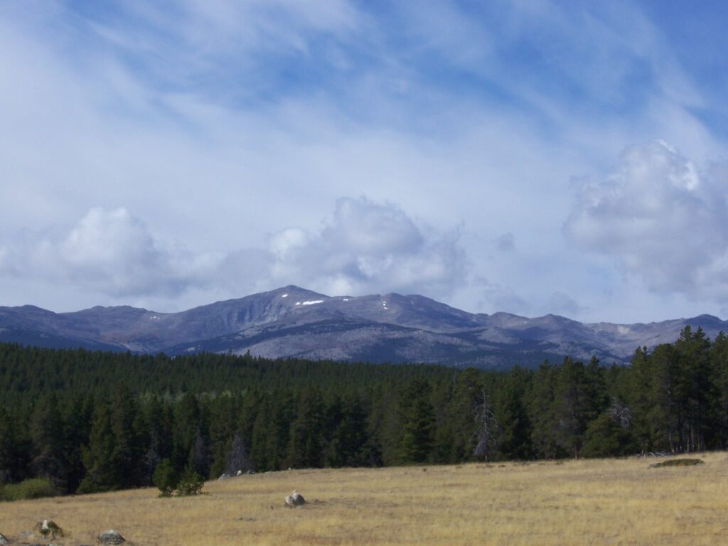
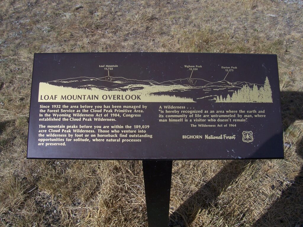
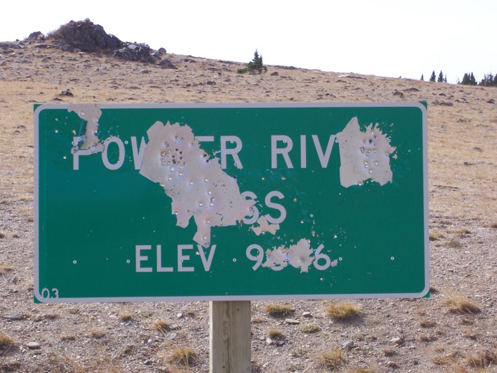
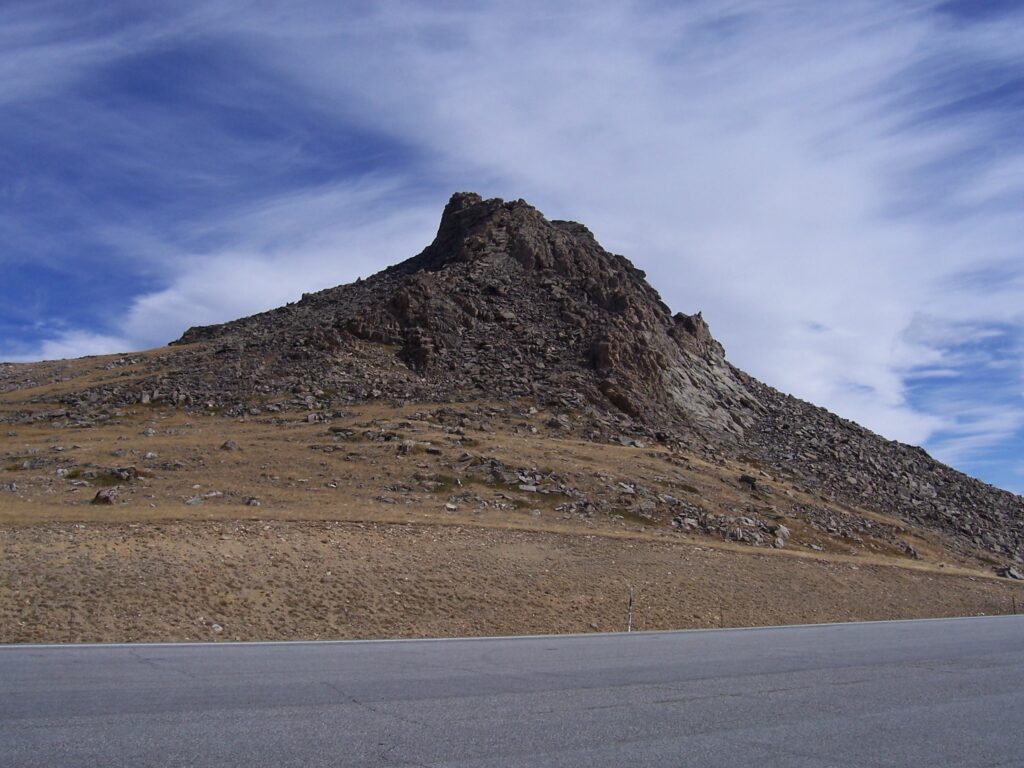
Eventually we pulled off at a scenic overlook to find we are looking at Loaf Mountain. The air is crisp here and the breezes are blowing strong. Back in the car we rumble along as if we are the only people on Earth for most of the morning, stopping here and there for photos. The Powder River Pass pull-off confirms our thoughts about elevation: we are at 9,666 feet! We are putting this little old car to the test.
Sunday brunch in Worland is a buffet among strangers who feel like family
As if the scenery were not enough, lunch turned out to be a special treat. It is Sunday and we are in God’s Country. High up in Worland, Wyoming, without our Sunday-go-to-Meeting clothes. We clean up as best we can and stop at a local restaurant for brunch.
As we enter, it is apparent that Sunday is buffet day – the food is situated at the far end of the restaurant and people are lined up in the aisle between the side booths and center tables. The place is packed and we are shown to the only clear booth at the other side of the room.
Everyone seemingly chats with everyone else as they slowly make it up to the buffet table. We feel like we’re some distant relatives who have shown up for the wedding party. Actually, I wondered they don’t all turn and ask who we are, what our relationship is to the bride or groom.
Eventually we found our way along the food line. There, sitting proudly among an array of colorful foods, was a big green bowl of Moldy Salad. Just like my Mom made for every summer picnic, for decades.
I confess. It made me smile and get all excited, scooping some onto my plate. Instantly, I was no longer a stranger. I suddenly was attached to these people in a way that defies description. Unknowingly, they gave me a gift as surely as Kathleen.
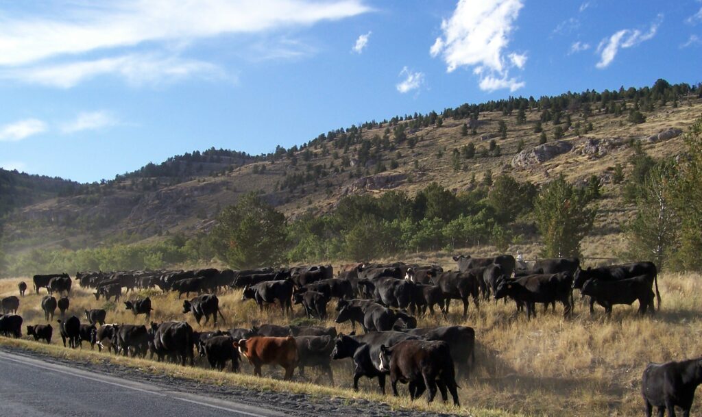
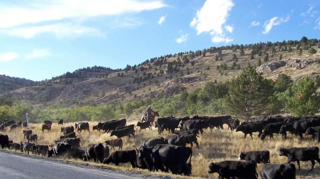
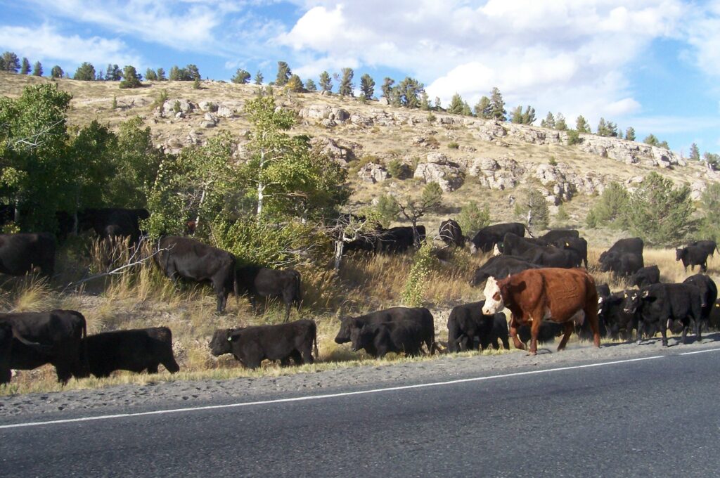
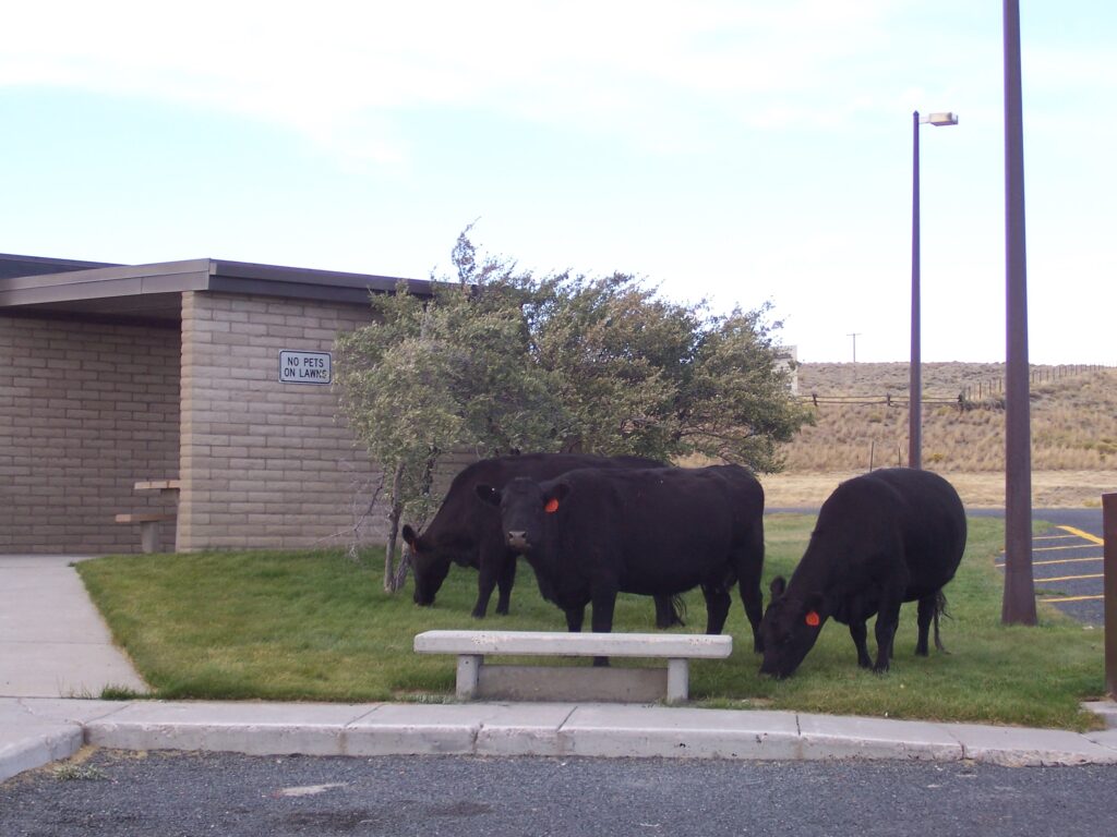
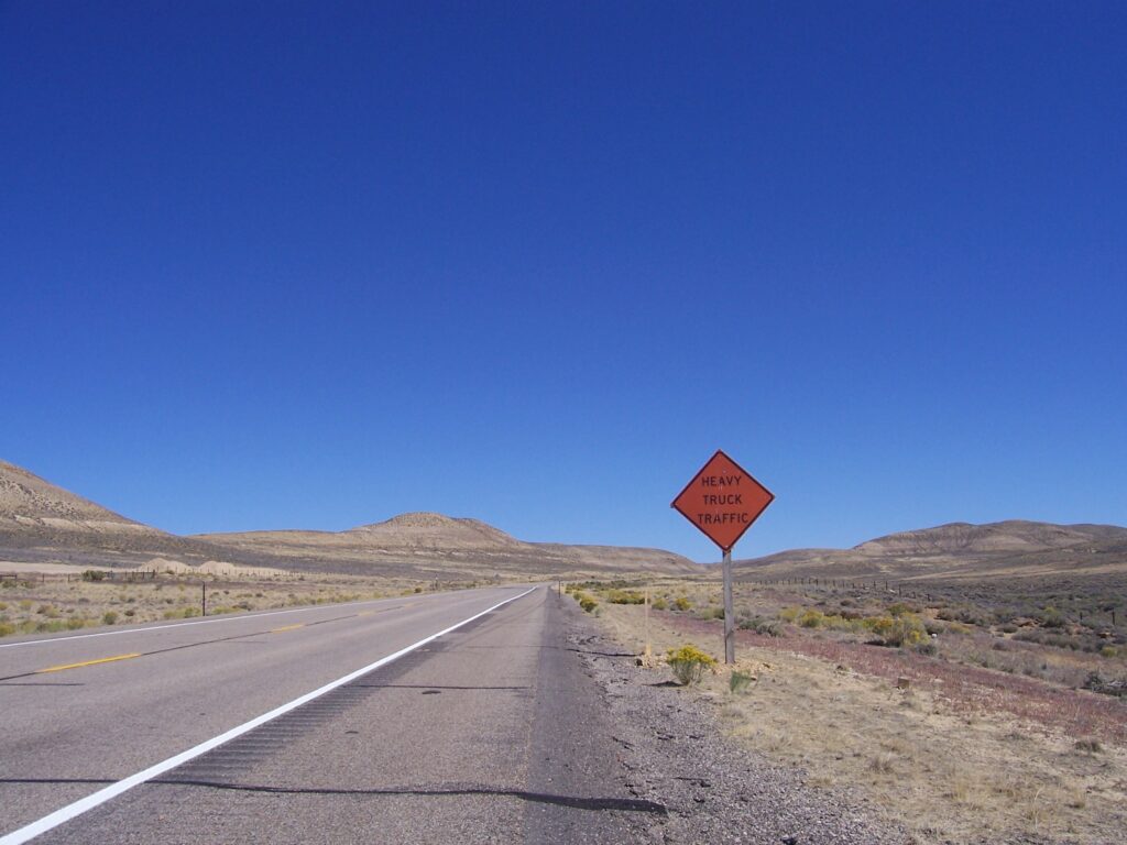
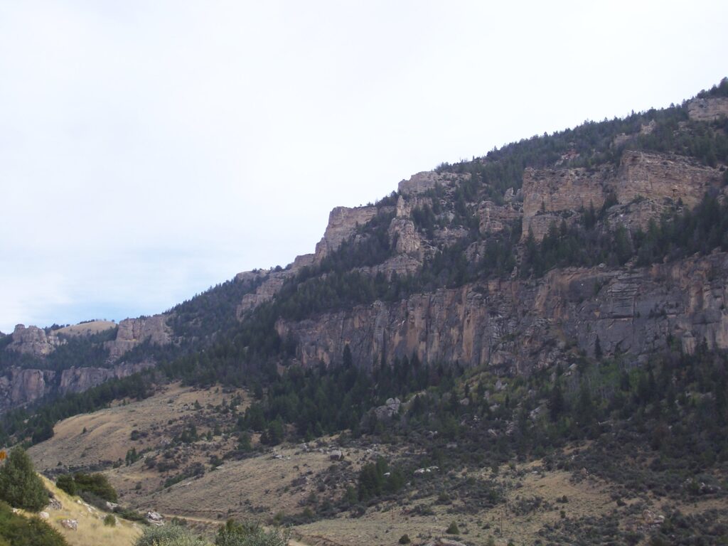
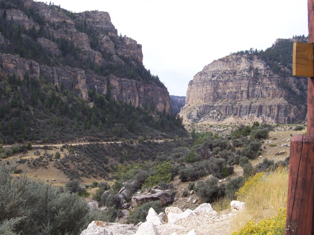
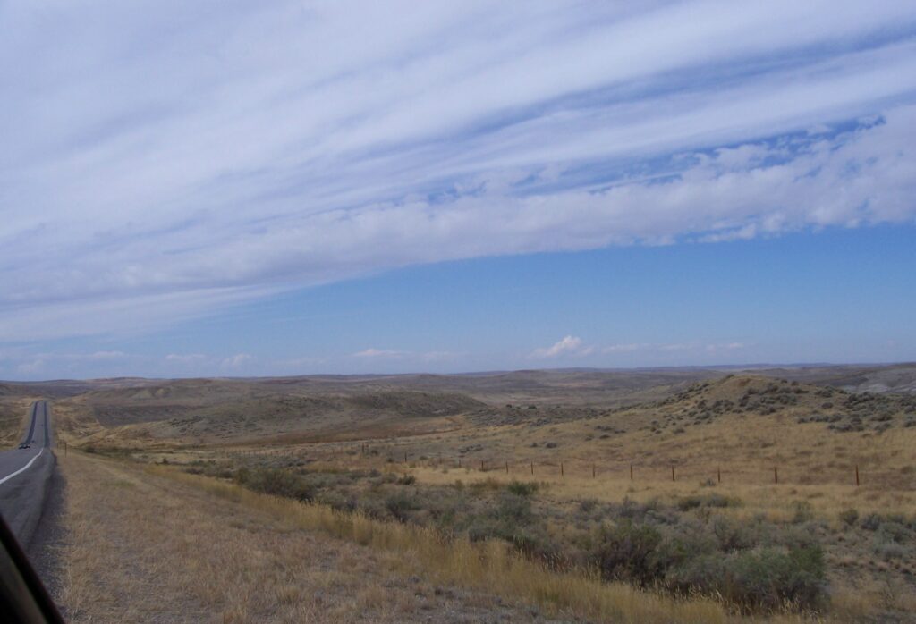
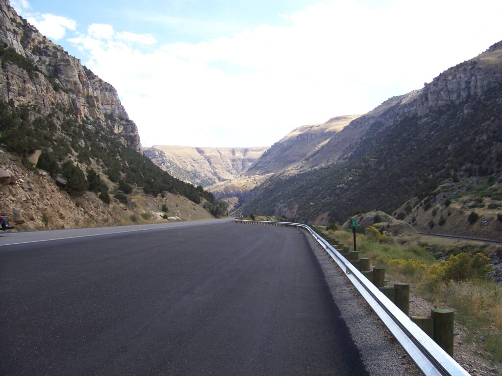
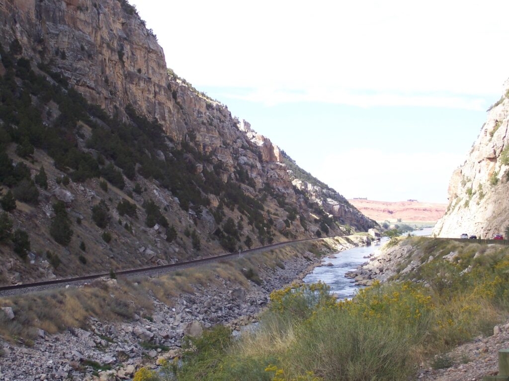
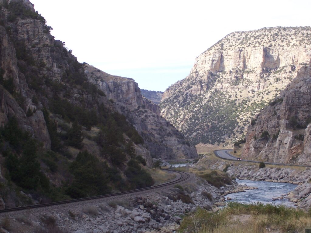
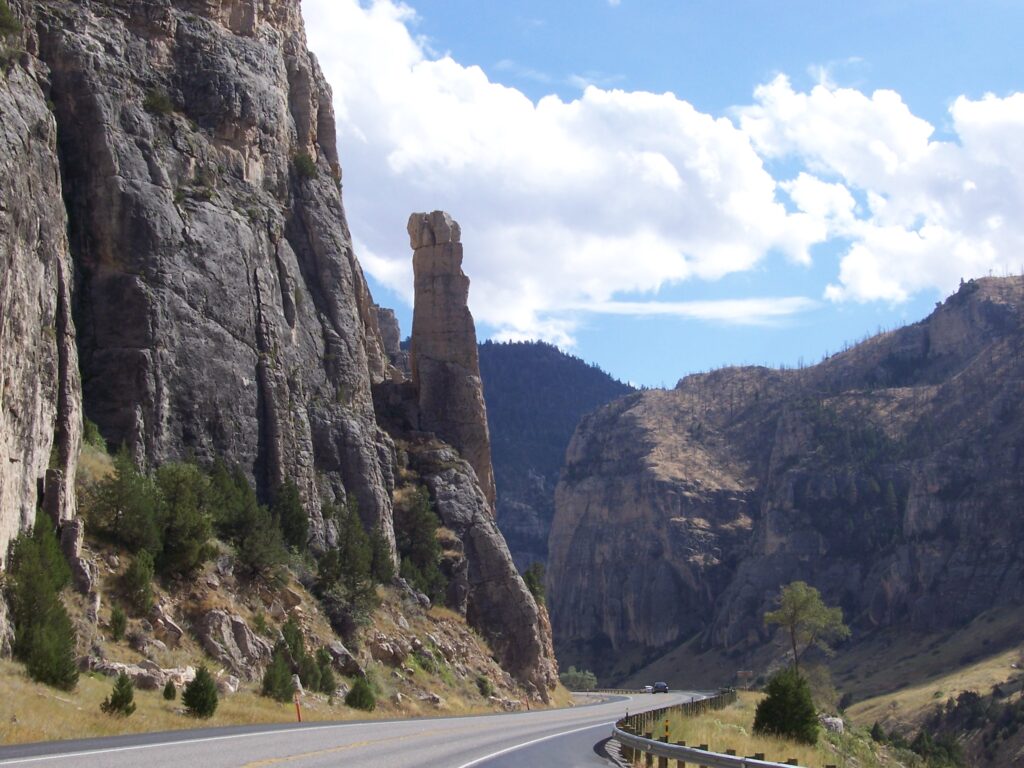
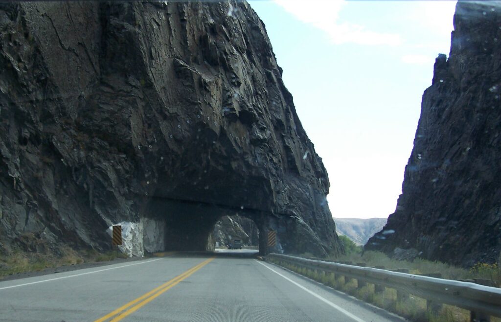
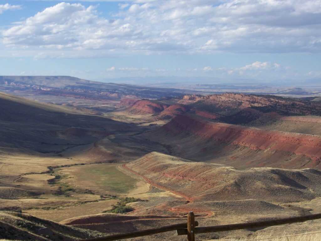
Our route wandered up through Ponderosa-like pine covered mountains, down through colorful limestone canyons, past a cattle drive complete with a real cowboy on horse, face-to-face with escaped cattle loudly munching grass under a “No Pets…” sign, sagebrush flats for as far as the eye could see on what appeared to be the top of the world and then, as if that were not enough contrast, poof: a city of 10,000 people, Rock Springs, Wyoming.
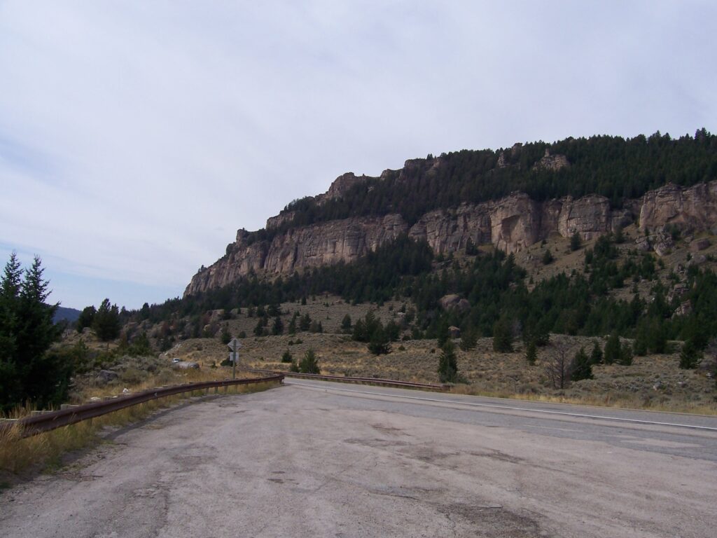
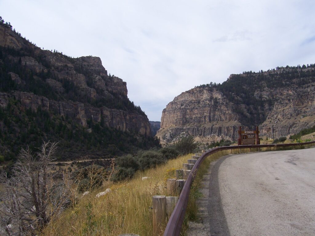
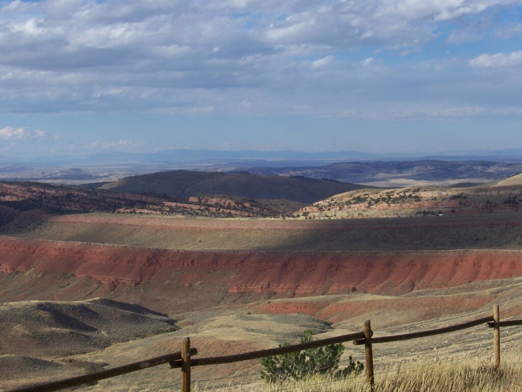
A great drive, beautiful scenery that just doesn’t stop, and air so crisp it reminds you that you’ve forgotten what fresh was all about. What more could we ask for? The canyons provide one amazing view after another as you wind down among the limestone cuts until you can hardly believe what you’ve seen. And the range land is everything you’ve ever imagined and better.
Even the town names proved interesting. As the story goes, it was common practice for Native Americans to measure distances in terms of how long it took to get from one place to another. Hence, the town of Tensleep became known for the distance – accounted for by the time it took to get there from Buffalo. Before someone asks, we don’t know whether that was on foot or horseback but we do know it was way before roads.
By the end of the day, as we descended into Rock Springs for the night, we could see where the “purple mountains majesty” came from. The setting sun behind these seemingly barren, but scrub-covered peaks casts a dark lavender haze that is too beautiful to capture or believe. Cattle land for sure, and very different from the South Dakota that we have come to love, but well worth the trip.
We feel fortunate to have had the time and the temperament to take this less traveled route. We heard someone say that, of the hundreds of thousands (millions?) of people who tour Yellowstone National Park each year, more than 99 percent never go more than 200 feet off the main roads leading in and out of the area. That is shorter than a city block in Manhattan or Chicago.
It isn’t that we’d wish those hoards of tourists on Tensleep, Worland or Thermopolis (or even on the untouched wilderness around Yellowstone for that matter), but that is a sad statistic. We are no experienced adventure guides; nor 50-pound pack carrying, Bermuda-short wearing, certified mountain climbers. But we will ask for maps at a ranger station or read the information at a trail head, grab a couple of bottles of water, a compass and give a trail a try.
If the going gets really rough or too steep for comfort we will turn back. If the trail is too long for the time we have, we just walk partway and backtrack. To make the effort to get to a place and yet to never truly experience what it feels like to be in that place is such a shame. There are times when it is best to leave behind the cacophony of sounds, lights and people that give color and substance to normal urban surroundings if you ever hope to find the beauty of the wilderness.
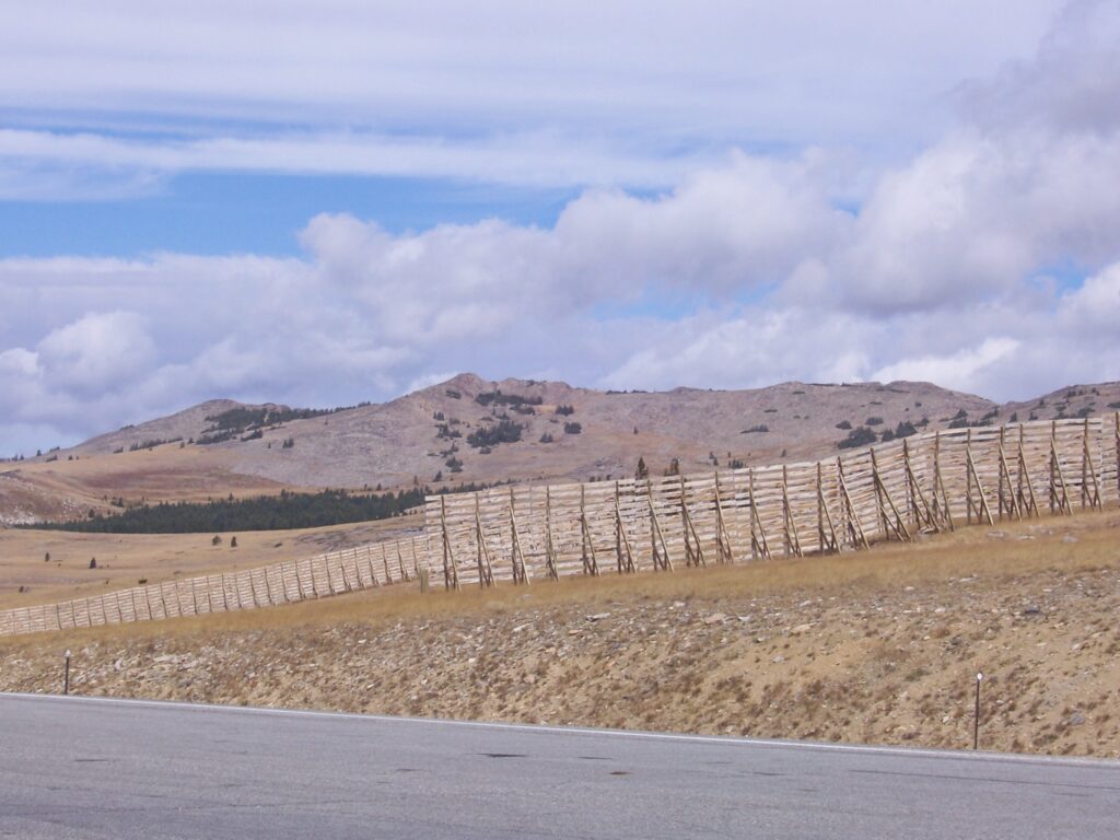
Powder River Pass
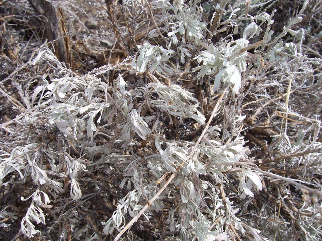
At 9,666 feet, Powder River Pass is the highest point on Highway 16 in the Big Horn National Forest. Harsh weather conditions and shallow soil discourages the growth of trees. Growing on the slopes of the pass are fragile plants of the Alpine Tundra that survive by clinging to the soil for just enough water and nutrients. Along the highway are snow fences that are in place to keep drifts off the road. During the winter, it isn’t unusual to have 10 foot drifts in the pass.
In June 2019, a high altitude tornado blew through Powder River Pass and cut a swath of trees down along a 3.7-mile path.
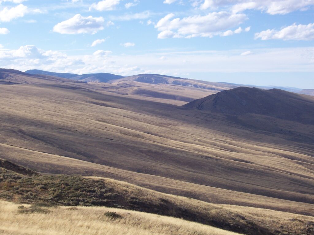
Managing the Range
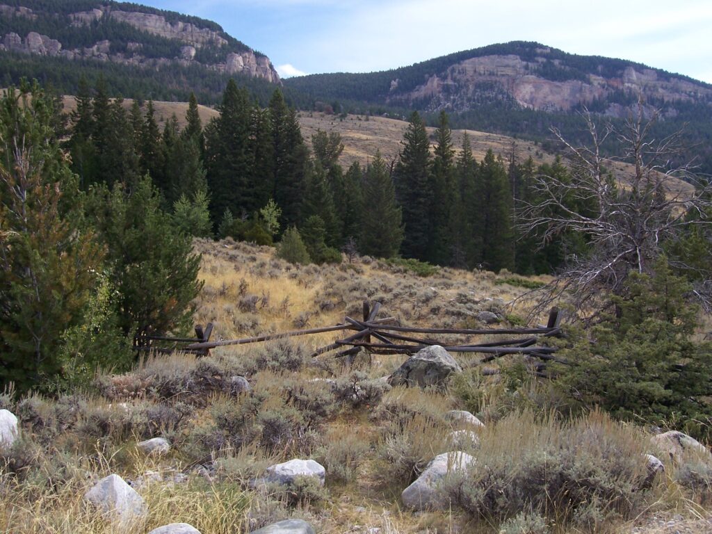
Tensleep Canyon to the Flatlands
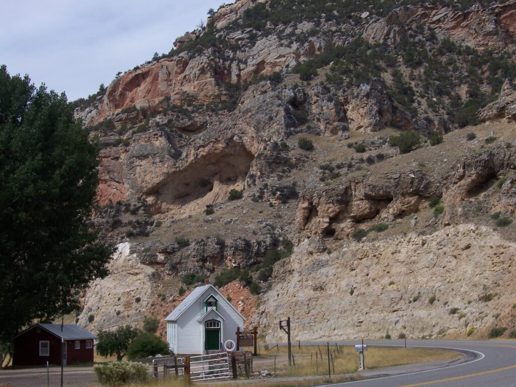
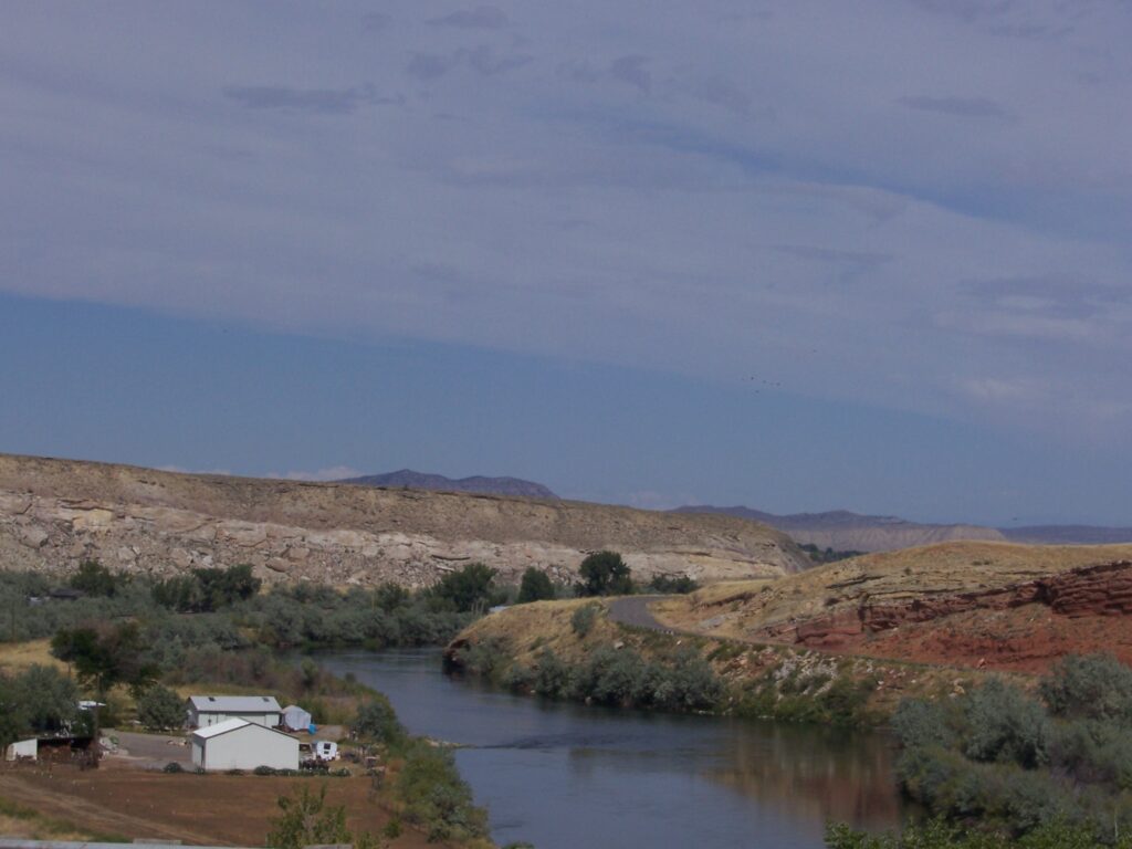
Thermopolis is the hidden gem of hot springs in Wyoming
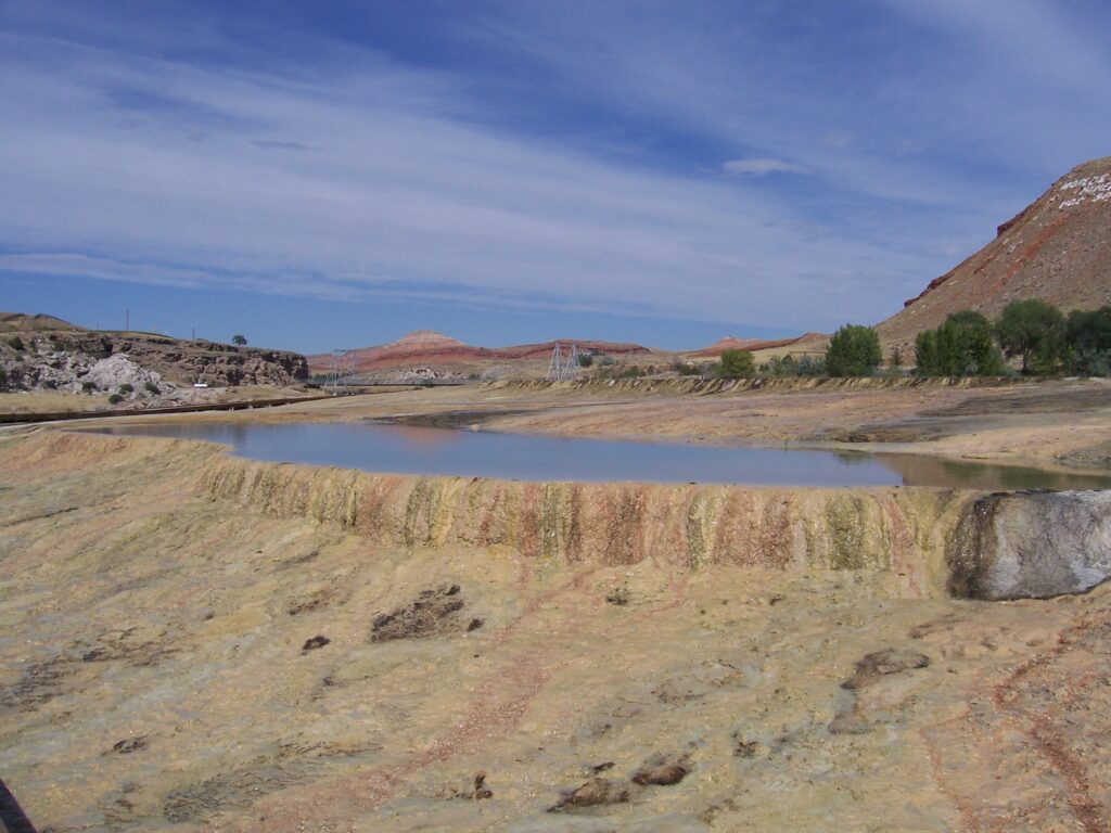
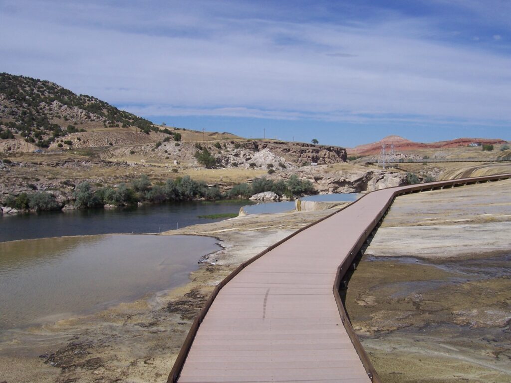
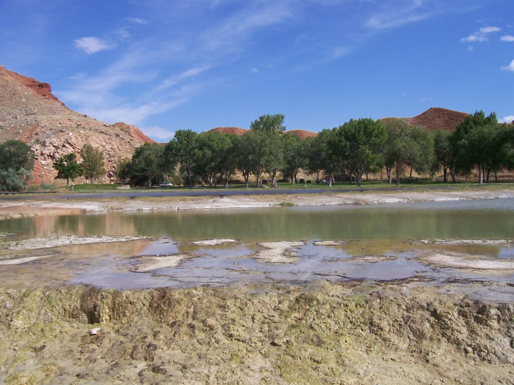
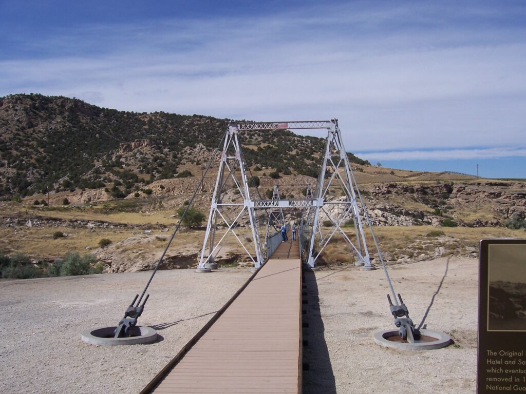
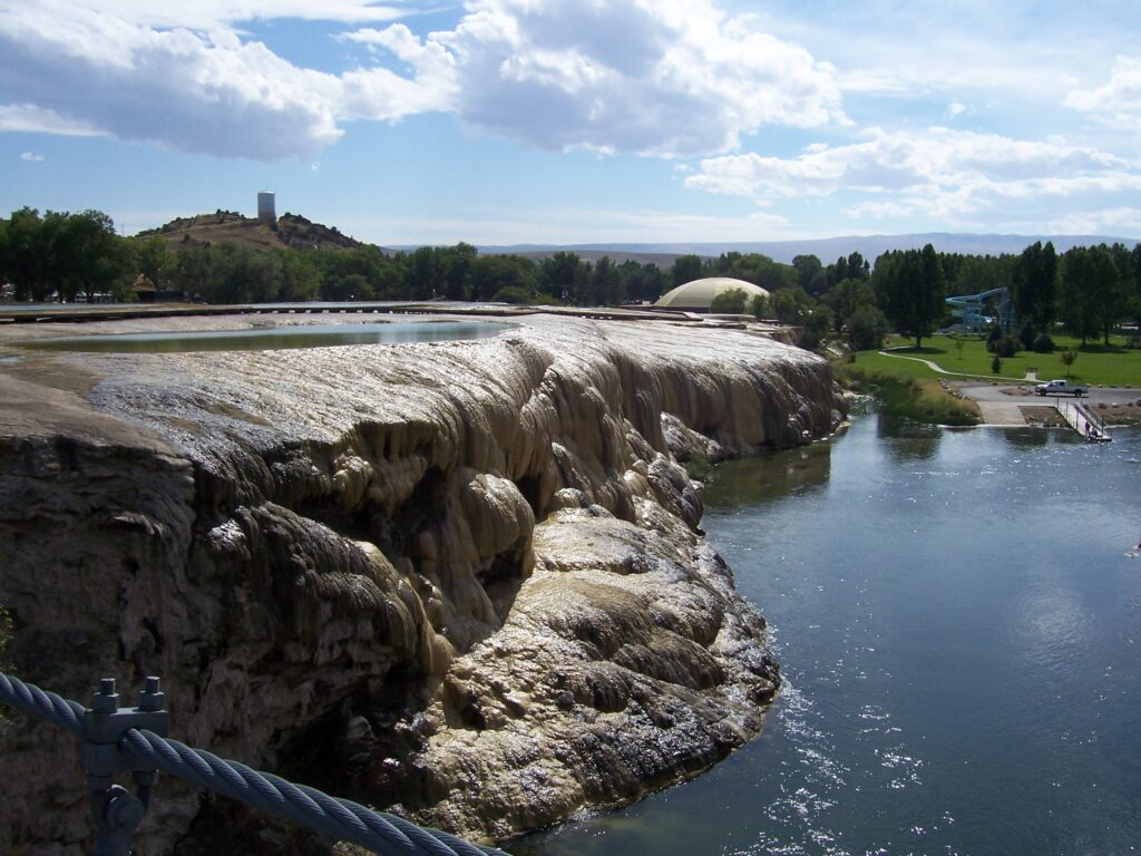
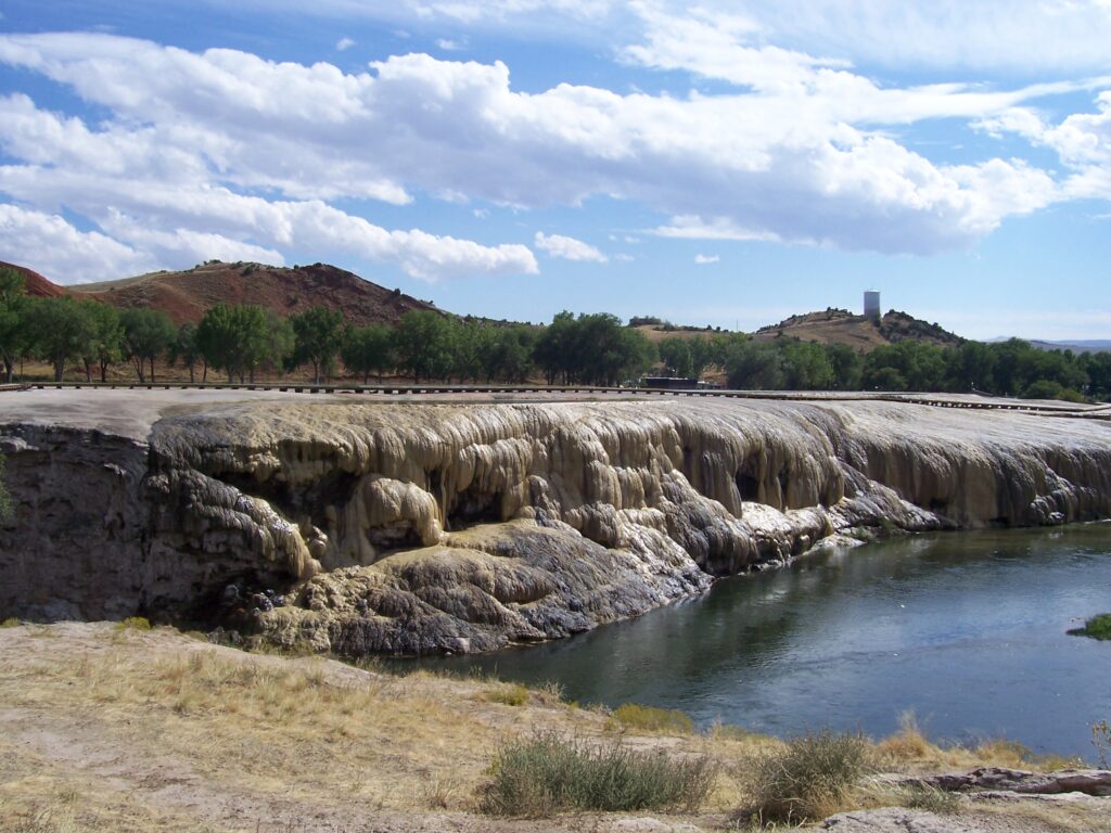
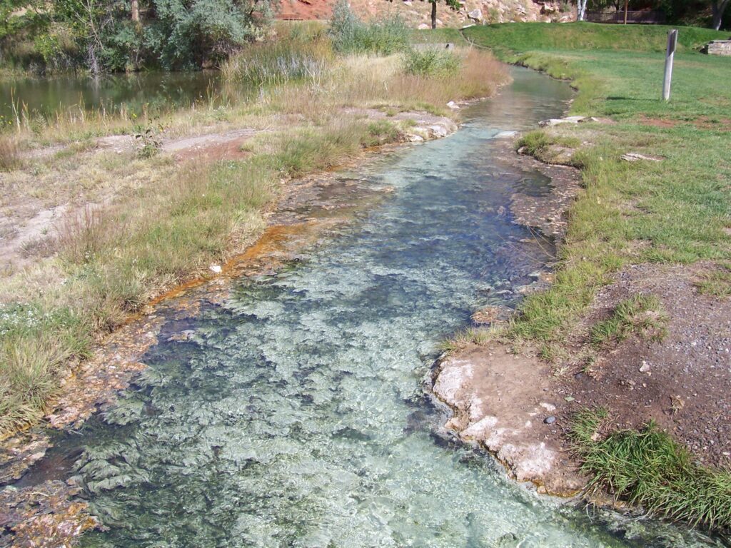
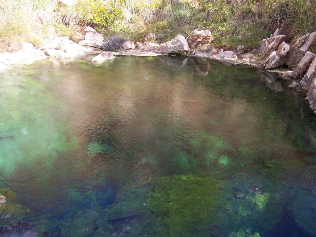
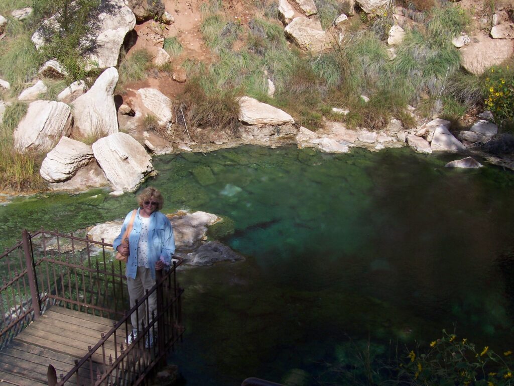
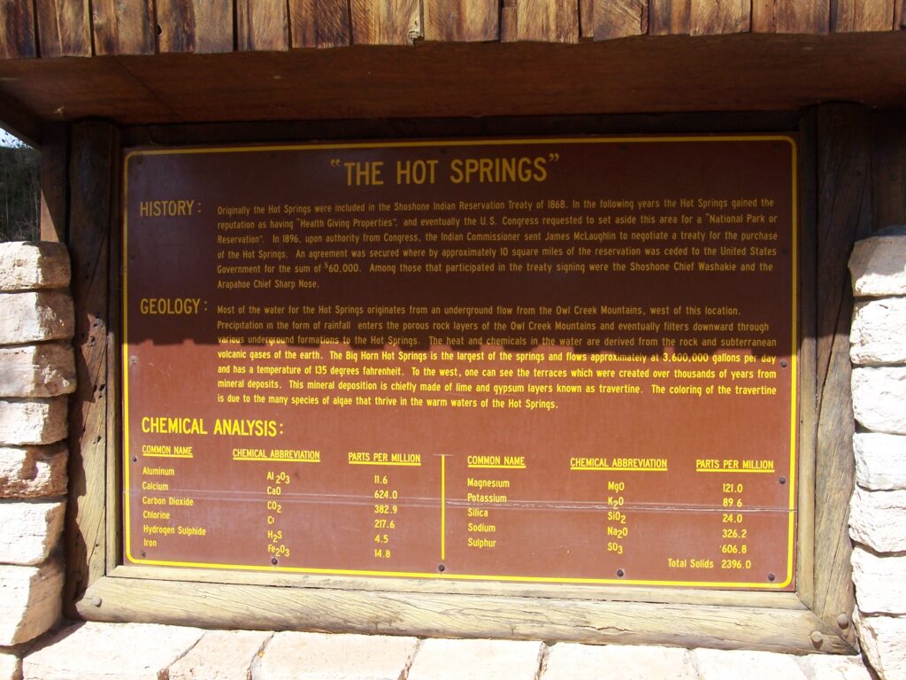
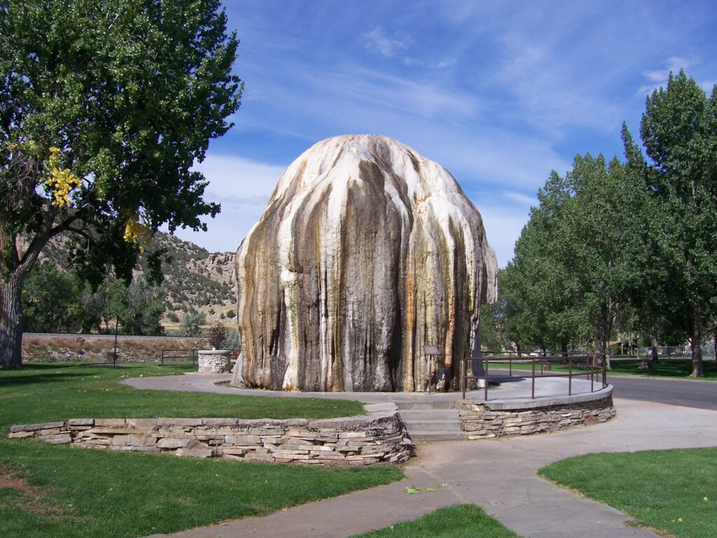
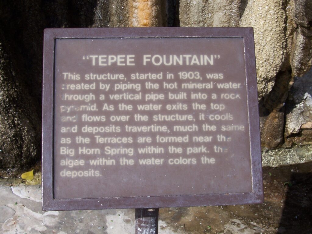
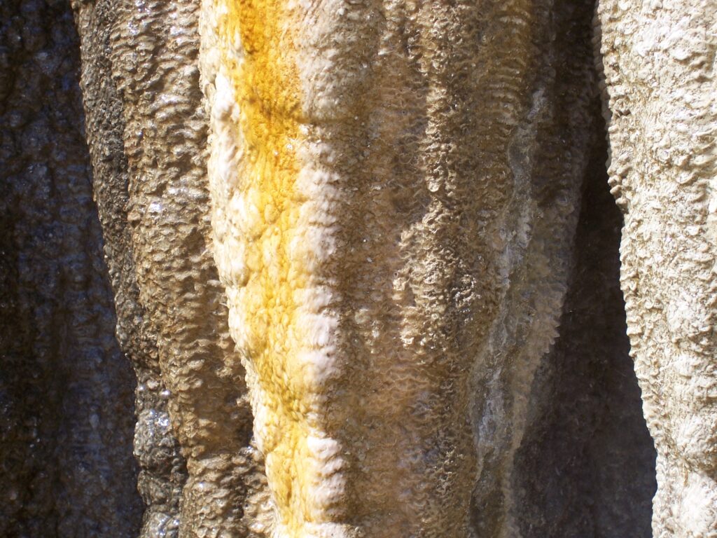
Thermopolis is a town of some 3,000 residents; home to the Thermopolis State Park and famous for its hot springs. We totally enjoyed our visit.
Leaving Thermopolis there were still many scenic spots along the way to the Red Canyon
Whoa, stop the car … it’s a cattle drive (by)